

Engel, Max
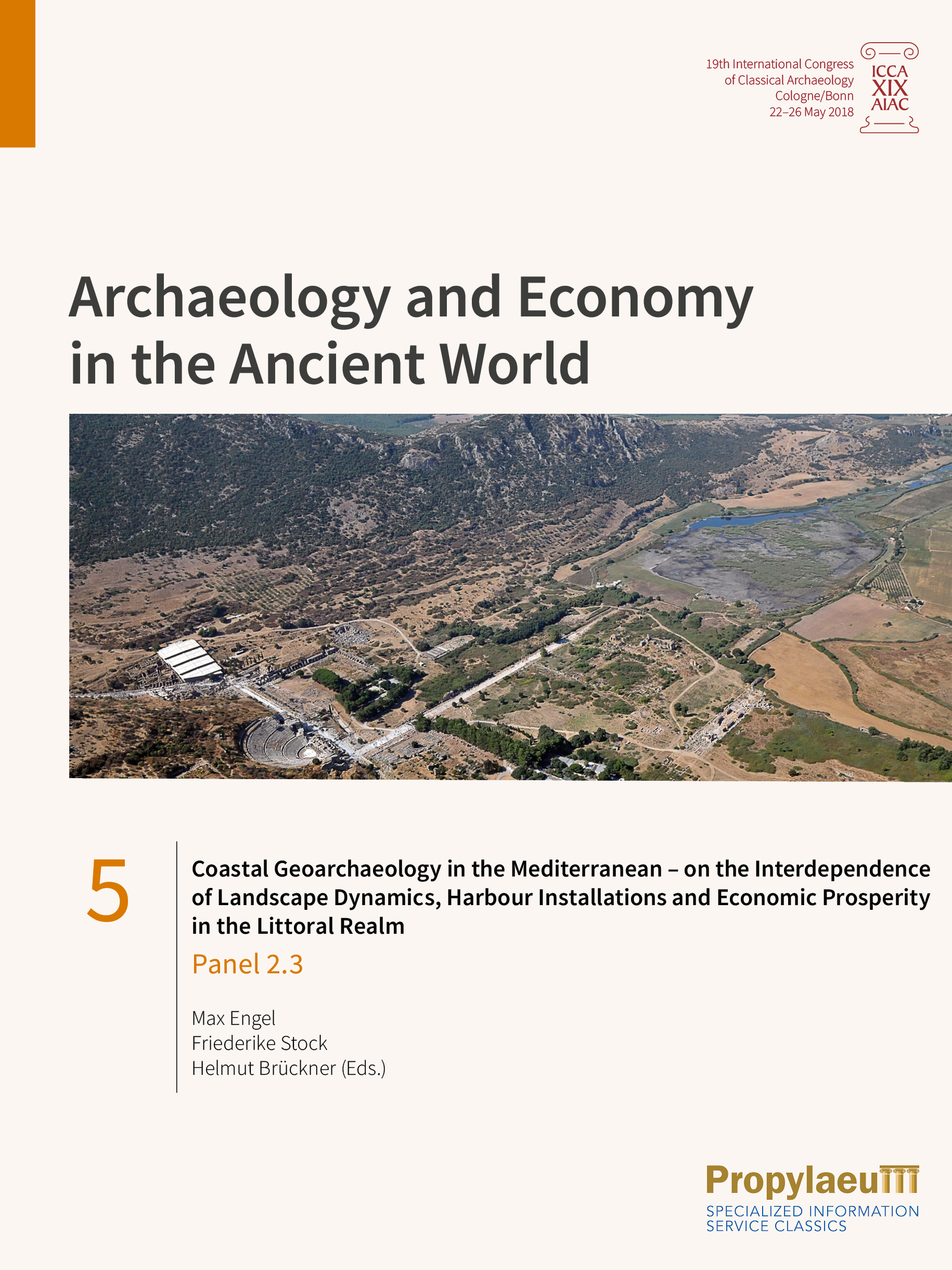
Coastal Geoarchaeology in the Mediterranean – on the Interdependence of Landscape Dynamics, Harbour Installations and Economic Prosperity in the Littoral Realm: Panel 2.3
Mediterranean coastlines are highly dynamic landscapes, shifting up to tens of kilometres during the last ca. six millennia in the case of prograding delta plains. In these low-lying coastal environments, many ancient harbour installations became landlocked with severe impacts on the political and economic situation as well as the status of urban centres and their hinterland. At the same time, rising relative sea levels may have resulted in the salinization of aquifers and adverse effects on agricultural production. This collection of papers from Panel 2.3 “Coastal geoarchaeology in the Mediterranean – on the interdependence of landscape dynamics, harbour installations and economic prosperity in the littoral realm” covers those topics for different parts of the Mediterranean geographical entity over the last 2500 years. These studies successfully demonstrate how geoscience data either help to locate harbour sites or how they support the interpretation of archaeological remains and literature sources of ancient authors. Each contribution therefore represents a striking example for the relevance of interdisciplinary approaches in archaeology, as summarized in the concept of geoarchaeology.
Römische Landnutzung im antiken Industrierevier der Osteifel
From the beginning of the Roman Imperial period, the area between Mayen on the edge of the Eifel and Andernach on the Rhine experienced an enormous increase in its economic activity. In a short time, an industrial area developed there, from which wide areas in the Roman north-western provinces were supplied with high-quality basalt lava millstones, light tuff and later also heat-resistant ceramics. Quarries were newly established, land and water routes were expanded, existing outlets were extended and others were still to be developed. Setbacks in the 3rd and 4th centuries were followed by further booms.
How could the numerous workers and their families be fed, and what consequences did the success of the stone and energy-intensive pottery industries have for the environment? In order to clarify this, two Roman villas on the northern edge of the Mayen millstone quarries were investigated with geophysical measurements, excavations, geoarchaeological and botanical studies, and their entire surroundings were explored. The results are presented in this book. The inhabitants of the villa Mendig, »Im Winkel« were themselves involved in the production of millstones. In late antiquity, a surface drainage system there probably kept a transhipment point for millstones on the Segbach dry, while a fortified storage building ensured the supply of the quarrymen. Quarry owners resided in the villa Mendig, »Lungenkärchen«. It turned out to be an axial courtyard with an impressive water basin. Inspections led to the discovery of the burial ground belonging to »Lungenkärchen« with monuments made of Lorraine limestone as well as the discovery of a previously unknown vicus »Im Terl«.